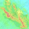
East Java topographic map
Click on the map to display elevation.
East Java
East Java has a tropical monsoon and savanna climate at lower elevation and subtropical at higher elevation. Compared with the western part of Java Island, East Java in general has less rainfall. Average rainfall is 1,900 mm per year, with a rainy season during the 100 days. The average temperature ranges between 19–34 °C. Temperatures in the lower mountain areas, and even in areas Ranu Pani (slopes of Mount Semeru), temperatures can reach –4 °C, causing a frost and fall of light snow.
About this map
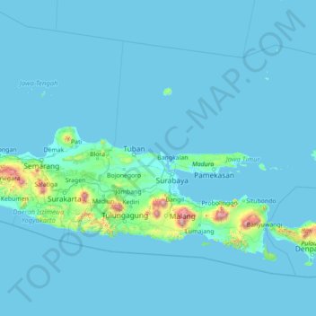
Name: East Java topographic map, elevation, terrain.
Location: East Java, Indonesia (-9.03014 110.88160 -4.89269 116.48418)
Average elevation: 62 m
Minimum elevation: -1 m
Maximum elevation: 3,481 m
Other topographic maps
Click on a map to view its topography, its elevation and its terrain.







Kopeng
Indonesia > Special Region of Yogyakarta > Sleman Regency > Kepuhharjo
Average elevation: 755 m




Kurnia Koto Salak
Indonesia > West Sumatra > Sungai Rumbai > Kurnia Koto Salak
Average elevation: 99 m