Geolocate

Sembulang topographic map

Click on the map to display elevation.

About this map

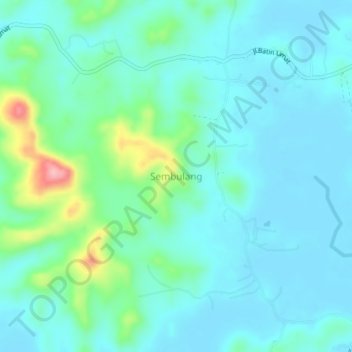
Name: Sembulang topographic map, elevation, terrain.

Location: Sembulang, Batam City, Riau Islands, Sumatra, Indonesia (0.81137 104.18787 0.85137 104.22787)

Average elevation: 30 m

Minimum elevation: 0 m

Maximum elevation: 157 m

Gear up for your next adventure:

🛶Kayak Accessories - Essential gear for safe and fun kayaking adventures
🥾Lightweight Hiking Boots - Boots for comfort and mobility on long hikes
💡LED Headlamp - Hands-free illumination for night hiking and camping
💡LED Camping Lantern - Illuminate your campsite with long-lasting lanterns
🧦Crew Hiking Socks - Comfortable socks for long-distance hikes

As an Amazon Associate, this site earns from qualifying purchases at no extra cost to you.