Geolocate

Pusuk topographic map

Click on the map to display elevation.

About this map

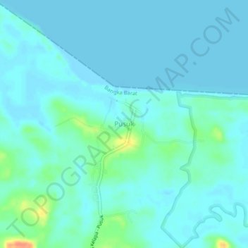
Name: Pusuk topographic map, elevation, terrain.

Location: Pusuk, Bangka Barat, Bangka-Belitung Islands, Indonesia (-1.80809 105.68193 -1.76809 105.72193)

Average elevation: 7 m

Minimum elevation: -1 m

Maximum elevation: 47 m

Gear up for your next adventure:

🛶Kayak Dry Bag - Waterproof storage for kayaking adventures
🧥Waterproof Hiking Jacket - Protect yourself from rain and wind while hiking
🚑Survival Whistle - Signal for help across long distances in mountains
🥾Light Hiking Boots - Lightweight and comfortable boots for day hikes
🧴Waterproofing Spray - Restore the DWR coating on jackets and tents

As an Amazon Associate, this site earns from qualifying purchases at no extra cost to you.