Geolocate

Windusari topographic map

Click on the map to display elevation.

About this map

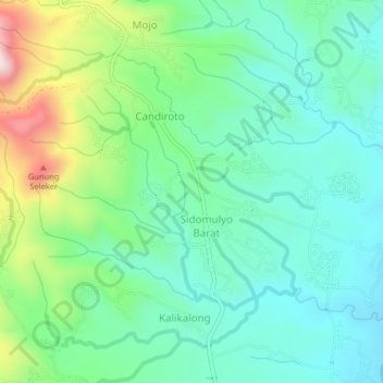
Name: Windusari topographic map, elevation, terrain.

Location: Windusari, Magelang, Central Java, 56195, Indonesia (-7.45480 110.17146 -7.41480 110.21146)

Average elevation: 460 m

Minimum elevation: 339 m

Maximum elevation: 781 m

Gear up for your next adventure:

🛰️Satellite Messenger - Emergency communication for areas with no cell service
🥾All-Terrain Hiking Boots - Versatile boots for varied hiking conditions
🔪Outdoor Multitool - Versatile tool for repairs and food prep in the wild
🎒Hiking Daypack - Lightweight and durable backpacks for day trips and excursions
🥾Trail Hiking Shoes - Durable shoes designed for rugged trails

As an Amazon Associate, this site earns from qualifying purchases at no extra cost to you.