Geolocate

Batok topographic map

Click on the map to display elevation.

About this map

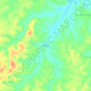
Name: Batok topographic map, elevation, terrain.

Location: Batok, Bogor, West Java, Indonesia (-6.39946 106.49020 -6.35946 106.53020)

Average elevation: 56 m

Minimum elevation: 35 m

Maximum elevation: 86 m

Gear up for your next adventure:

🧤Thermal Hiking Gloves - Grip-enhanced gloves for cold-weather altitude trekking
🧭GPS Outdoor Watch - Smart watch for navigation and fitness tracking in nature
🛌Down Sleeping Bag - Superior warmth-to-weight ratio for cold nights
🥾Mountain Trail Shoes - High-traction shoes for mountain trails
🔋Lithium AA Batteries - Long-lasting power that performs in extreme cold

As an Amazon Associate, this site earns from qualifying purchases at no extra cost to you.