Geolocate

Jatiluhur topographic map

Click on the map to display elevation.

About this map

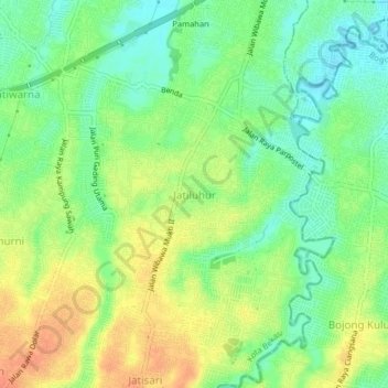
Name: Jatiluhur topographic map, elevation, terrain.

Location: Jatiluhur, Kota Bekasi, West Java, 17425, Indonesia (-6.34021 106.93037 -6.30021 106.97037)

Average elevation: 43 m

Minimum elevation: 23 m

Maximum elevation: 64 m

Gear up for your next adventure:

🥾Trail Running Boots - Durable shoes designed for trail running
🛶Kayak Accessories - Essential gear for safe and fun kayaking adventures
🧦Hiking Socks - Moisture-wicking and comfortable socks for long hikes
🧦Crew Hiking Socks - Comfortable socks for long-distance hikes
🥾Lightweight Hiking Boots - Boots for comfort and mobility on long hikes

As an Amazon Associate, this site earns from qualifying purchases at no extra cost to you.