Geolocate

Jogyakarta topographic map

Click on the map to display elevation.

About this map

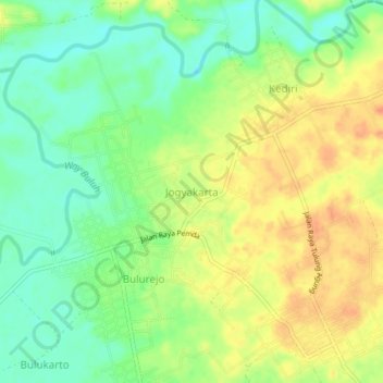
Name: Jogyakarta topographic map, elevation, terrain.

Location: Jogyakarta, Pringsewu, Lampung, Indonesia (-5.36498 105.01108 -5.32498 105.05108)

Average elevation: 102 m

Minimum elevation: 82 m

Maximum elevation: 121 m

Gear up for your next adventure:

🦶Anti-Blister Balm - Prevents friction and hotspots during long ascents
🧴First Aid Kit - Essential first aid supplies for outdoor emergencies
🥤Collapsible Travel Cup - Saves space and weight in your mess kit
👖Convertible Hiking Pants - Zip-off legs to adapt to changing weather conditions
Camping Tent - Weather-resistant tents suitable for 2 to 6 people

As an Amazon Associate, this site earns from qualifying purchases at no extra cost to you.