Geolocate

Balinggama topographic map

Click on the map to display elevation.

About this map

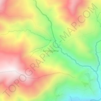
Name: Balinggama topographic map, elevation, terrain.

Location: Balinggama, Yahukimo, Highland Papua, Indonesia (-4.35517 139.28616 -4.31517 139.32616)

Average elevation: 2,479 m

Minimum elevation: 1,887 m

Maximum elevation: 3,043 m

Gear up for your next adventure:

🧥Insulated Jacket - Keep warm in cold outdoor conditions
🧥Softshell Jacket - Windproof and breathable jacket for hiking
🎒Hiking Backpack - Lightweight and ergonomic backpacks for day hikes or multi-day treks
🥾Waterproof Trail Shoes - Shoes designed to handle wet terrain
👟Trail Running Shoes - Agile footwear for fast-paced topographic exploration

As an Amazon Associate, this site earns from qualifying purchases at no extra cost to you.