Geolocate

Pencil topographic map

Click on the map to display elevation.

👉 Easily get elevation data in JSON, GeoTIFF and KML formats using Elevation API
Thank you for supporting this site ❤️
Make a donation

About this map

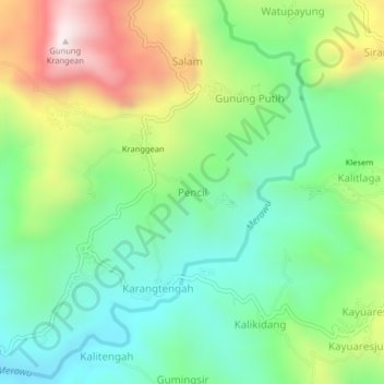
Name: Pencil topographic map, elevation, terrain.

Location: Pencil, Banjarnegara, Central Java, Java, Indonesia (-7.32487 109.74977 -7.28487 109.78977)

Average elevation: 777 m

Minimum elevation: 515 m

Maximum elevation: 1,257 m

Gear up for your next adventure:

🥾Mountain Hiking Shoes - Shoes with superior grip for mountainous terrain
💡Solar Camping Lamp - Eco-friendly lighting for campsites
🧴Waterproofing Spray - Restore the DWR coating on jackets and tents
🚲Bike Repair Kit - Essential tools for on-trail mechanical issues
🥾Waterproof Hiking Boots - Boots keeping your feet dry in wet conditions

As an Amazon Associate, this site earns from qualifying purchases at no extra cost to you.