

Syria topographic maps
Click on a map to view its topography, its elevation and its terrain.


Barada River
Syria > Damascus Governorate > Damascus Subdistrict > Sarouja Municipality
Average elevation: 754 m


ساحة الميسات
Syria > Damascus Governorate > Damascus Subdistrict > As-Salihiya Municipality
Average elevation: 759 m


New Cham Suburb
Syria > Damascus Governorate > Damascus Subdistrict > Dummar Municipality
Average elevation: 870 m


حديقة 17 نيسان
Syria > Damascus Governorate > Damascus Subdistrict > Kafr Sousa Municipality
Average elevation: 700 m

Al Qabun Neighborhood
Syria > Damascus Governorate > Damascus Subdistrict > Al-Qaboun Municipality
Average elevation: 734 m


Has
Hass (Arabic: حَاسٌّ, romanized: Ḥāss) is a town in northwestern Syria, administratively part of the Ma'arrat al-Numan District of the Idlib Governorate. The town has an altitude of 630 meters above sea level. According to the Syria Central Bureau of Statistics, Hass had a population of 9,595 in the…
Average elevation: 591 m


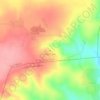
Zawiya Mountain
Syria > Idleb Governorate > Ar Ruwayhah
The average elevation of Mount Zāwiya is 750 m. The highest point is Mount Ayyūb (939 m). The western side of the mountain is steep, but the eastern side slopes gradually. Many springs and streams arise on the western side and drain into the Rouge and Ghāb plains.
Average elevation: 540 m


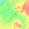


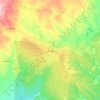


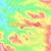


Khan Shaykhoun
Khan Shaykhun is located at an altitude of 350 meters on the main highway between Aleppo and Damascus. The local economy is primarily agricultural, focusing on the growing of cotton and cereals. The town was formerly known for producing embroidery. Nearby localities include Hbit to the west, Kafr Zita to…
Average elevation: 385 m






Barada River
Syria > Damascus Governorate > Damascus Subdistrict > Al-Qanawat Municipality
Average elevation: 703 m


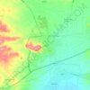
Al-Bab
Al-Bab (Arabic: الْبَاب / ALA-LC: al-Bāb) is a city, de jure administratively belonging to the Aleppo Governorate of the Syrian Arab Republic. As of December 2016, the city is under the control of pro-Turkish militias, as part of the Turkish occupation of northern Syria. Al-Bab is located 40 kilometres…
Average elevation: 471 m


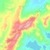


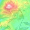


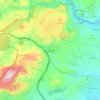
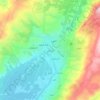
Az-Zabadani
Syria > Rif Dimashq Governorate
Al-Zabadani or Az-Zabadani (Arabic: الزبداني, romanized: az-Zabadānī) is a city and popular hill station in southwestern Syria in the Rif Dimashq Governorate, close to the border with Lebanon. It is located in the center of a green valley surrounded by high mountains at an elevation of around 1,100 m.
Average elevation: 1,429 m
