Geolocate

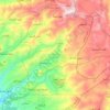
Al-Kafrun topographic map

Click on the map to display elevation.

About this map

Name: Al-Kafrun topographic map, elevation, terrain.

Location: Al-Kafrun, Al-Qumsiya Subdistrict, Ash-Sheikh Badr District, Tartus Governorate, Syria (35.05312 35.96696 35.09312 36.00696)

Average elevation: 292 m

Minimum elevation: 55 m

Maximum elevation: 603 m

Other topographic maps

Click on a map to view its topography, its elevation and its terrain.

Jazirat Al-Abbas

Syria > Tartus Governorate > Tartus

Average elevation: 0 m

Gear up for your next adventure:

🛶Canoe Life Vest - Safety vest for water sports
🧴Waterproofing Spray - Restore the DWR coating on jackets and tents
🧤Thermal Hiking Gloves - Grip-enhanced gloves for cold-weather altitude trekking
👟Leg Gaiters - Keep debris, mud, and snow out of your boots
🧊Insulated Water Bottle - Keeps drinks cold in summer and prevents freezing in winter

As an Amazon Associate, this site earns from qualifying purchases at no extra cost to you.