Geolocate

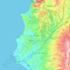
Al-Qalaye topographic map

Click on the map to display elevation.

About this map

Name: Al-Qalaye topographic map, elevation, terrain.

Location: Al-Qalaye, Ain ash-Sharqiya Subdistrict, Jable District, Latakia Governorate, Syria (35.33588 36.02189 35.37588 36.06189)

Average elevation: 172 m

Minimum elevation: 92 m

Maximum elevation: 287 m

Other topographic maps

Click on a map to view its topography, its elevation and its terrain.

سد برادون

Syria > Latakia Governorate

Average elevation: 227 m

Lattakia District

Syria > Latakia Governorate

Average elevation: 284 m

Lattakia District

Syria > Latakia Governorate

Average elevation: 284 m

Gear up for your next adventure:

🛶Waterproof Dry Bags - Keep electronics and clothes dry during river crossings
⛺Camping Tent - Weather-resistant tents suitable for 2 to 6 people
🌬️Windproof Camp Stove - Efficient cooking even on exposed mountain peaks
🥾Light Hiking Boots - Lightweight and comfortable boots for day hikes
🥾Approach Shoes - Shoes designed for climbing approaches and rugged trails

As an Amazon Associate, this site earns from qualifying purchases at no extra cost to you.