Geolocate

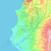
As-Sarsakiye topographic map

Click on the map to display elevation.

About this map

Name: As-Sarsakiye topographic map, elevation, terrain.

Location: As-Sarsakiye, Ain al-Beida Subdistrict, Lattakia District, Latakia Governorate, Syria (35.68734 35.90846 35.72734 35.94846)

Average elevation: 148 m

Minimum elevation: 36 m

Maximum elevation: 381 m

Other topographic maps

Click on a map to view its topography, its elevation and its terrain.

سد برادون

Syria > Latakia Governorate

Average elevation: 227 m

Lattakia District

Syria > Latakia Governorate

Average elevation: 284 m

Lattakia District

Syria > Latakia Governorate

Average elevation: 284 m

Gear up for your next adventure:

🦶Hiking Shoe Insoles - Added support for high arches and long days on feet
👟Sport Hiking Sandals - Breathable footwear for water crossings and camp rest
🛁Quick-Dry Microfiber Towel - Space-saving towel that dries rapidly on the move
🔦LED Flashlight - Powerful and long-lasting flashlight for camping and emergencies
🧴Outdoor Sunscreen - High SPF protection for high-altitude UV exposure

As an Amazon Associate, this site earns from qualifying purchases at no extra cost to you.