Geolocate

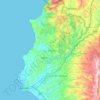
Kort topographic map

Click on the map to display elevation.

About this map

Name: Kort topographic map, elevation, terrain.

Location: Kort, Kinnsiba Subdistrict, Al-Haffa District, Latakia Governorate, Syria (35.67976 36.08637 35.71976 36.12637)

Average elevation: 463 m

Minimum elevation: 206 m

Maximum elevation: 702 m

Other topographic maps

Click on a map to view its topography, its elevation and its terrain.

سد برادون

Syria > Latakia Governorate

Average elevation: 227 m

Lattakia District

Syria > Latakia Governorate

Average elevation: 284 m

Lattakia District

Syria > Latakia Governorate

Average elevation: 284 m

Gear up for your next adventure:

🪑Ultralight Camping Stool - Compact seating for rest stops during long hikes
🧢Hiking Sun Hat - Wide-brimmed protection for exposed mountain ridges
🌬️Windproof Camp Stove - Efficient cooking even on exposed mountain peaks
🧢Hiking Hat - Sun-protective and breathable hats for long treks
🥾Mountain Trail Shoes - High-traction shoes for mountain trails

As an Amazon Associate, this site earns from qualifying purchases at no extra cost to you.