Geolocate

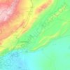
Sarghaya topographic map

Click on the map to display elevation.

About this map

Name: Sarghaya topographic map, elevation, terrain.

Location: Sarghaya, Sarghaya district, Az-Zabadani District, Rif Dimashq Governorate, Syria (33.77164 36.11961 33.85164 36.19961)

Average elevation: 1,644 m

Minimum elevation: 1,109 m

Maximum elevation: 2,462 m

Other topographic maps

Click on a map to view its topography, its elevation and its terrain.

Qudsaiya District

Syria > Rif Dimashq Governorate

Average elevation: 1,322 m

Qatana District

Syria > Rif Dimashq Governorate

Average elevation: 1,122 m

Al Nabek dam

Syria > Rif Dimashq Governorate

Average elevation: 1,247 m

Qatana District

Syria > Rif Dimashq Governorate

Average elevation: 1,122 m

Duma District

Syria > Rif Dimashq Governorate

Average elevation: 801 m

Zarzar Lake

Syria > Rif Dimashq Governorate

Average elevation: 1,201 m

Gear up for your next adventure:

💧Hydration Pack - Hands-free hydration system for long hikes
🥾Approach Shoes - Shoes designed for climbing approaches and rugged trails
⛺Lightweight Camping Tent - Portable shelter optimized for Canadian backcountry camping
🧦Outdoor Socks - Durable socks designed for hiking and outdoor sports
🔨Vehicle Emergency Tool - Safety tool for remote road trips to trailheads

As an Amazon Associate, this site earns from qualifying purchases at no extra cost to you.