Geolocate

Ura topographic map

Click on the map to display elevation.

About this map
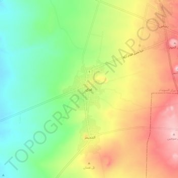
Name: Ura topographic map, elevation, terrain.

Location: Ura, As-Suweida Subdistrict, As-Suweida District, As-Suweida Governorate, Syria (32.57667 36.49333 32.65667 36.57333)

Average elevation: 952 m

Minimum elevation: 828 m

Maximum elevation: 1,125 m

Other topographic maps

Click on a map to view its topography, its elevation and its terrain.

Al Raha Dam

Syria > As-Suweida Governorate > Ar-Raha

Average elevation: 1,155 m

Gear up for your next adventure:

🪑Insulated Seat Pad - Protect your seat from cold rocks and wet logs
🥾Hiking Gaiters - Protect legs and shoes from mud, snow, and debris
🧣Merino Neck Gaiter - Protects against wind, sun, and cold at high altitudes
🍽️Titanium Camping Spork - Ultralight and indestructible eating utensil
🥾Trekking Boots - Durable boots for long-distance trekking

As an Amazon Associate, this site earns from qualifying purchases at no extra cost to you.