Geolocate

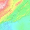
Ain Terma topographic map

Click on the map to display elevation.

About this map

Name: Ain Terma topographic map, elevation, terrain.

Location: Ain Terma, Kafr Batna Subdistrict, Rif Dimashq District, Rif Dimashq Governorate, Syria (33.49441 36.32892 33.53441 36.36892)

Average elevation: 675 m

Minimum elevation: 648 m

Maximum elevation: 715 m

Other topographic maps

Click on a map to view its topography, its elevation and its terrain.

Qudsaiya District

Syria > Rif Dimashq Governorate

Average elevation: 1,322 m

Qatana District

Syria > Rif Dimashq Governorate

Average elevation: 1,122 m

Al Nabek dam

Syria > Rif Dimashq Governorate

Average elevation: 1,247 m

Qatana District

Syria > Rif Dimashq Governorate

Average elevation: 1,122 m

Duma District

Syria > Rif Dimashq Governorate

Average elevation: 801 m

Zarzar Lake

Syria > Rif Dimashq Governorate

Average elevation: 1,201 m

Gear up for your next adventure:

🧴Sunscreen SPF - Broad-spectrum sunscreen for outdoor activities
🔦UV Flashlight - Detect minerals or specific insects in the dark
📷Outdoor Action Camera - Capture high-elevation views and rugged adventures
🪑Insulated Seat Pad - Protect your seat from cold rocks and wet logs
🦶Anti-Blister Balm - Prevents friction and hotspots during long ascents

As an Amazon Associate, this site earns from qualifying purchases at no extra cost to you.