Geolocate

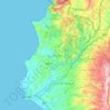
Daryus topographic map

Click on the map to display elevation.

About this map

Name: Daryus topographic map, elevation, terrain.

Location: Daryus, Slenfa Subdistrict, Al-Haffa District, Latakia Governorate, Syria (35.56292 36.12025 35.60292 36.16025)

Average elevation: 778 m

Minimum elevation: 482 m

Maximum elevation: 1,015 m

Other topographic maps

Click on a map to view its topography, its elevation and its terrain.

سد برادون

Syria > Latakia Governorate

Average elevation: 227 m

Lattakia District

Syria > Latakia Governorate

Average elevation: 284 m

Lattakia District

Syria > Latakia Governorate

Average elevation: 284 m

Gear up for your next adventure:

🥫Freeze-Dried Meals - Lightweight, high-calorie nutrition for multi-day treks
🚲Bike Repair Kit - Essential tools for on-trail mechanical issues
🧴Sunscreen SPF - Broad-spectrum sunscreen for outdoor activities
🧊Portable Cooler - Keep food and drinks cold during outdoor adventures
🥾Waterproof Hiking Boots - Boots keeping your feet dry in wet conditions

As an Amazon Associate, this site earns from qualifying purchases at no extra cost to you.