Geolocate

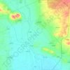
Al-Mahsana topographic map

Click on the map to display elevation.

About this map

Name: Al-Mahsana topographic map, elevation, terrain.

Location: Al-Mahsana, Jarablus Subdistrict, Jarablus District, Aleppo Governorate, Syria (36.62714 37.86240 36.66714 37.90240)

Average elevation: 430 m

Minimum elevation: 393 m

Maximum elevation: 467 m

Other topographic maps

Click on a map to view its topography, its elevation and its terrain.

Lake Jabbūl

Syria > Aleppo Governorate

Average elevation: 356 m

Citadel of Aleppo

Syria > Aleppo Governorate > Aleppo

Average elevation: 393 m

Queiq

Syria > Aleppo Governorate

Average elevation: 415 m

سبخة المطخ

Syria > Aleppo Governorate

Average elevation: 245 m

Al-Hader Subdistrict

Syria > Aleppo Governorate

Average elevation: 276 m

Derbazîn Horî

Syria > Aleppo Governorate

Average elevation: 400 m

Tash

Syria > Aleppo Governorate

Average elevation: 480 m

Jindires Subdistrict

Syria > Aleppo Governorate

Average elevation: 316 m

Gear up for your next adventure:

🥽Outdoor Goggles - Protective eyewear for outdoor activities
🔦LED Headtorch - Bright and durable light for night activities
🥾Light Hiking Boots - Lightweight and comfortable boots for day hikes
🧢Outdoor Visor - Breathable visor for sunny hikes
⛺Lightweight Backpacking Tent - Compact tent for efficient hiking trips

As an Amazon Associate, this site earns from qualifying purchases at no extra cost to you.