Geolocate

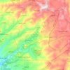
Ar-Rawda topographic map

Click on the map to display elevation.

About this map

Name: Ar-Rawda topographic map, elevation, terrain.

Location: Ar-Rawda, Ar-Rawda Subdistrict, Banyas District, Tartus Governorate, Syria (35.05287 35.89351 35.09287 35.93351)

Average elevation: 92 m

Minimum elevation: 0 m

Maximum elevation: 277 m

Other topographic maps

Click on a map to view its topography, its elevation and its terrain.

Jazirat Al-Abbas

Syria > Tartus Governorate > Tartus

Average elevation: 0 m

Gear up for your next adventure:

🥾Approach Shoes - Shoes designed for climbing approaches and rugged trails
🧥Ultralight Puffy Jacket - Maximum warmth that packs down to the size of an orange
👟Leg Gaiters - Keep debris, mud, and snow out of your boots
💧Hydration Pack - Hands-free hydration system for long hikes
🧭Orienteering Kit - Tools for map reading and navigation in the wild

As an Amazon Associate, this site earns from qualifying purchases at no extra cost to you.