Geolocate

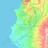
Beit Yashut topographic map

Click on the map to display elevation.

About this map

Name: Beit Yashut topographic map, elevation, terrain.

Location: Beit Yashut, Beit Yashut Subdistrict, Jable District, Latakia Governorate, Syria (35.27663 36.08387 35.35663 36.16387)

Average elevation: 658 m

Minimum elevation: 211 m

Maximum elevation: 1,232 m

Other topographic maps

Click on a map to view its topography, its elevation and its terrain.

سد برادون

Syria > Latakia Governorate

Average elevation: 227 m

Lattakia District

Syria > Latakia Governorate

Average elevation: 284 m

Lattakia District

Syria > Latakia Governorate

Average elevation: 284 m

Gear up for your next adventure:

🎒Hiking Backpack - Lightweight and ergonomic backpacks for day hikes or multi-day treks
🧥Thermal Layer - Insulating layer for cold outdoor conditions
💧Filtered Water Bottle - Safe drinking water on the go
🧰Survival Kit - Essential gear for emergencies in the wilderness
🦟Insect Repellent - Keep mosquitoes and black flies away in wooded areas

As an Amazon Associate, this site earns from qualifying purchases at no extra cost to you.