Geolocate

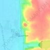
Jamala topographic map

Click on the map to display elevation.

About this map

Name: Jamala topographic map, elevation, terrain.

Location: Jamala, As-Salamiye Subdistrict, As-Salamiye District, Hama Governorate, Syria (34.94752 36.92056 34.98752 36.96056)

Average elevation: 469 m

Minimum elevation: 402 m

Maximum elevation: 494 m

Other topographic maps

Click on a map to view its topography, its elevation and its terrain.

Orontes River

Syria > Hama Governorate > Qarqur

Average elevation: 175 m

Hama

Syria > Hama Governorate

Average elevation: 311 m

Hama

Syria > Hama Governorate

Average elevation: 311 m

Hama

Syria > Hama Governorate

Average elevation: 311 m

Qalaat al-Madiq

Syria > Hama Governorate

Average elevation: 215 m

Hama

Syria > Hama Governorate

Average elevation: 311 m

Qalaat al-Madiq

Syria > Hama Governorate

Average elevation: 215 m

Hama

Syria > Hama Governorate

Average elevation: 311 m

Gear up for your next adventure:

🔭Compact Monocular - One-handed bird watching and trail spotting
🥾Waterproof Trail Shoes - Shoes designed to handle wet terrain
💡LED Headlamp - Hands-free illumination for night hiking and camping
🥾Mountaineering Boots - Supportive boots for climbing and high-altitude hiking
🧭GPS Handheld Device - Reliable GPS navigation for outdoor adventures

As an Amazon Associate, this site earns from qualifying purchases at no extra cost to you.