Geolocate

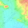
Tiyara topographic map

Click on the map to display elevation.

About this map

Name: Tiyara topographic map, elevation, terrain.

Location: Tiyara, Heraitan Subdistrict, Mount Simeon District, Aleppo Governorate, Syria (36.18517 37.27136 36.22517 37.31136)

Average elevation: 418 m

Minimum elevation: 383 m

Maximum elevation: 465 m

Other topographic maps

Click on a map to view its topography, its elevation and its terrain.

Lake Jabbūl

Syria > Aleppo Governorate

Average elevation: 356 m

Citadel of Aleppo

Syria > Aleppo Governorate > Aleppo

Average elevation: 393 m

Queiq

Syria > Aleppo Governorate

Average elevation: 415 m

سبخة المطخ

Syria > Aleppo Governorate

Average elevation: 245 m

Al-Hader Subdistrict

Syria > Aleppo Governorate

Average elevation: 276 m

Derbazîn Horî

Syria > Aleppo Governorate

Average elevation: 400 m

Tash

Syria > Aleppo Governorate

Average elevation: 480 m

Jindires Subdistrict

Syria > Aleppo Governorate

Average elevation: 316 m

Gear up for your next adventure:

🕶️Polarized Sunglasses - Reduces glare from snow and water at high elevations
👟Trail Running Shoes - Agile footwear for fast-paced topographic exploration
🛶Kayak Accessories - Essential gear for safe and fun kayaking adventures
🥾All-Terrain Hiking Boots - Versatile boots for varied hiking conditions
🔋Emergency Crank Radio - Weather alerts and power without needing batteries

As an Amazon Associate, this site earns from qualifying purchases at no extra cost to you.