Geolocate

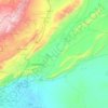
Saqba topographic map

Click on the map to display elevation.

About this map

Name: Saqba topographic map, elevation, terrain.

Location: Saqba, Kafr Batna Subdistrict, Rif Dimashq District, Rif Dimashq Governorate, Syria (33.49848 36.35992 33.53848 36.39992)

Average elevation: 659 m

Minimum elevation: 638 m

Maximum elevation: 696 m

Other topographic maps

Click on a map to view its topography, its elevation and its terrain.

Qudsaiya District

Syria > Rif Dimashq Governorate

Average elevation: 1,322 m

Qatana District

Syria > Rif Dimashq Governorate

Average elevation: 1,122 m

Al Nabek dam

Syria > Rif Dimashq Governorate

Average elevation: 1,247 m

Qatana District

Syria > Rif Dimashq Governorate

Average elevation: 1,122 m

Duma District

Syria > Rif Dimashq Governorate

Average elevation: 801 m

Zarzar Lake

Syria > Rif Dimashq Governorate

Average elevation: 1,201 m

Gear up for your next adventure:

🔭Compact Monocular - One-handed bird watching and trail spotting
🧢Outdoor Cap - Protective cap for sun and rain during hikes
🥾Light Trekking Boots - Supportive boots for multi-day treks
🧣Evaporative Cooling Towel - Beat the heat during intense summer climbs
🔦LED Headtorch - Bright and durable light for night activities

As an Amazon Associate, this site earns from qualifying purchases at no extra cost to you.