Geolocate

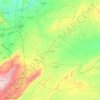
Ash-Shame topographic map

Click on the map to display elevation.

About this map

Name: Ash-Shame topographic map, elevation, terrain.

Location: Ash-Shame, Taldou Subdistrict, Taldou District, Homs Governorate, Syria (34.81996 36.59924 34.85996 36.63924)

Average elevation: 430 m

Minimum elevation: 399 m

Maximum elevation: 447 m

Other topographic maps

Click on a map to view its topography, its elevation and its terrain.

Kadesh

Syria > Homs Governorate > Qadesh

Average elevation: 504 m

Homs District

Syria > Homs Governorate

Average elevation: 836 m

Homs

Syria > Homs Governorate

Average elevation: 516 m

Lake Homs

Syria > Homs Governorate > Zor Baqraya

Average elevation: 504 m

Homs

Syria > Homs Governorate

Average elevation: 516 m

Wa'er Neighborhood

Syria > Homs Governorate

Average elevation: 489 m

Tadmur Subdistrict

Syria > Homs Governorate

Average elevation: 631 m

Homs

Syria > Homs Governorate

Average elevation: 516 m

Gear up for your next adventure:

🧥Waterproof Hiking Jacket - Protect yourself from rain and wind while hiking
🗺️Topographic Maps - Detailed maps to explore trails, mountains, and wilderness areas
🪑Insulated Seat Pad - Protect your seat from cold rocks and wet logs
👟Trail Running Shoes - Agile footwear for fast-paced topographic exploration
🌬️Windproof Camp Stove - Efficient cooking even on exposed mountain peaks

As an Amazon Associate, this site earns from qualifying purchases at no extra cost to you.