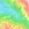
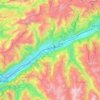
Leuk topographic map
Click on the map to display elevation.
About this map
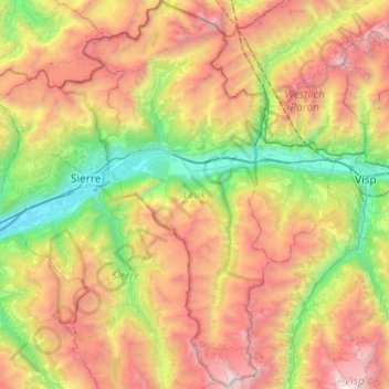
Name: Leuk topographic map, elevation, terrain.
Location: Leuk, Wallis, Switzerland (46.11075 7.52860 46.44505 7.76248)
Average elevation: 2,007 m
Minimum elevation: 495 m
Maximum elevation: 4,214 m
Other topographic maps
Click on a map to view its topography, its elevation and its terrain.
Monte Rosa
Switzerland > Wallis > Visp > Zermatt
The peak is distinguished by the name Dufourspitze (in German, lit. Dufour Peak; French: Pointe Dufour, Italian: Punta Dufour). This replaced the former name Höchste Spitze (English: Highest Peak) that was indicated on the Swiss maps before the Federal Council, on January 28, 1863, decided to rename the…
Average elevation: 4,033 m

Monte Rosa
Switzerland > Wallis > Visp > Zermatt
The peak is distinguished by the name Dufourspitze (in German, lit. Dufour Peak; French: Pointe Dufour, Italian: Punta Dufour). This replaced the former name Höchste Spitze (English: Highest Peak) that was indicated on the Swiss maps before the Federal Council, on January 28, 1863, decided to rename the…
Average elevation: 4,033 m

Eau-Rouge
Switzerland > Wallis > Entremont > Chamoille (Sembrancher) > Les Champmanins
Average elevation: 1,034 m
Dents du Midi
Switzerland > Wallis > Monthey > Val-d'Illiez
The Dents du Midi are situated on the border between the communes of Val-d'Illiez and Evionnaz. The north face rises above the Val d'Illiez while the south face overlooks the Lac de Salanfe, an artificial reservoir. The ridge of the chain is situated at an altitude varying between 2,997 and 3,258 meters (9,833…
Average elevation: 2,440 m
Torgon
Switzerland > Wallis > Monthey
Torgon is a village in the Swiss Alps, located in the canton of Valais. It lies on the western part of the canton, in the region of the Chablais, at an altitude of 1,085 metres. The village sits on a sunny terrace overlooking the Rhone valley, above Vionnaz. Politically Torgon belongs to the latter town.
Average elevation: 884 m

Lac Vert
Switzerland > Wallis > Monthey > Val-d'Illiez
Lake Vert is a lake in the Chablais region of the canton of Valais, Switzerland. The lake is located in the municipality of Val-d'Illiez, at an elevation of 1972 metres, near the border with France. Lac de Chésery lies 600 metres north.
Average elevation: 1,932 m

Col de la Forclaz
Switzerland > Wallis > Martigny > Trient > Col de la Forclaz
Average elevation: 1,637 m
Oberwald
Switzerland > Wallis > Goms > Obergoms
It is situated at an elevation of 1,377 m and had a population of 277 in December 2007. It is located at the end of the Goms, directly before the Furka and Grimsel passes, underneath the Rhône River source at the Rhône Glacier. It is also the startpoint of the Furka Tunnel and is served by Oberwald railway…
Average elevation: 1,744 m


Mase
Switzerland > Wallis > Hérens > Mont-Noble
The village is located in the Hérens district on the right bank of the Borgne and the left bank of the Rhone in the Val d'Hérens at an elevation of 1,345 m (4,413 ft). It consists of the village of Mase.
Average elevation: 1,272 m


Les Briesses
Switzerland > Wallis > Sierre > Crans-Montana > Chermignon-d'en-Bas
Average elevation: 1,179 m
Oberwald
Switzerland > Wallis > Goms > Obergoms
It is situated at an elevation of 1,377 m and had a population of 277 in December 2007. It is located at the end of the Goms, directly before the Furka and Grimsel passes, underneath the Rhône River source at the Rhône Glacier. It is also the startpoint of the Furka Tunnel and is served by Oberwald railway…
Average elevation: 1,744 m