Geolocate

Ly topographic map

Click on the map to display elevation.

About this map

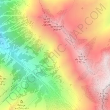
Name: Ly topographic map, elevation, terrain.

Location: Ly, Trient, Martigny, Wallis, 1929, Switzerland (46.02146 7.01306 46.04146 7.03306)

Average elevation: 2,234 m

Minimum elevation: 1,497 m

Maximum elevation: 2,831 m

Gear up for your next adventure:

🧴Insect Repellent - Protect yourself from bugs during outdoor adventures
🧥Insulated Jacket - Keep warm in cold outdoor conditions
🚲Handlebar Phone Mount - View topographic-map.com live while cycling
🪜Heavy Duty Carabiners - Multi-use clips for securing gear to your backpack
🛏️Camping Sleeping Mat - Comfortable mats for sleeping outdoors

As an Amazon Associate, this site earns from qualifying purchases at no extra cost to you.