Geolocate

Le Guercet topographic map

Click on the map to display elevation.

About this map

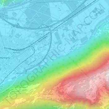
Name: Le Guercet topographic map, elevation, terrain.

Location: Le Guercet, Martigny, Wallis, 1927, Switzerland (46.08427 7.07920 46.12427 7.11920)

Average elevation: 718 m

Minimum elevation: 452 m

Maximum elevation: 1,500 m

Gear up for your next adventure:

🏃Hydration Running Vest - Carry water and maps close to your body for speed
🥫Freeze-Dried Meals - Lightweight, high-calorie nutrition for multi-day treks
🧦Outdoor Socks - Durable socks designed for hiking and outdoor sports
💡Solar Camping Lamp - Eco-friendly lighting for campsites
🔥Camping Stove - Portable stoves to cook outdoors with ease

As an Amazon Associate, this site earns from qualifying purchases at no extra cost to you.