Geolocate

Gletsch topographic map

Click on the map to display elevation.

About this map

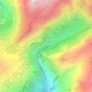
Name: Gletsch topographic map, elevation, terrain.

Location: Gletsch, Obergoms, Goms, Wallis, 3999, Switzerland (46.54214 8.34151 46.58214 8.38151)

Average elevation: 2,090 m

Minimum elevation: 1,435 m

Maximum elevation: 2,763 m

Other topographic maps

Click on a map to view its topography, its elevation and its terrain.

Rhonegletscher

Switzerland > Wallis > Goms > Obergoms

Average elevation: 2,805 m

Gear up for your next adventure:

🧦Crew Hiking Socks - Comfortable socks for long-distance hikes
🥾Waterproof Hiking Boots - Essential footwear for rugged terrain and wet Canadian trails
🦶Anti-Blister Balm - Prevents friction and hotspots during long ascents
🏃Hydration Running Vest - Carry water and maps close to your body for speed
🛏️Sleeping Bag - Warm and compact sleeping bags for outdoor camping

As an Amazon Associate, this site earns from qualifying purchases at no extra cost to you.