Geolocate

Les Collons topographic map

Click on the map to display elevation.

About this map

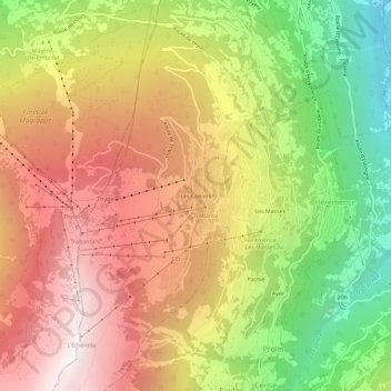
Name: Les Collons topographic map, elevation, terrain.

Location: Les Collons, Vex, Hérens, Wallis, 2305, Switzerland (46.16134 7.36514 46.20134 7.40514)

Average elevation: 1,586 m

Minimum elevation: 612 m

Maximum elevation: 2,448 m

Gear up for your next adventure:

🧥Waterproof Hiking Jacket - Protect yourself from rain and wind while hiking
🥾Waterproof Hiking Boots - Essential footwear for rugged terrain and wet Canadian trails
🧭GPS Tracker - Track your location in remote areas safely
Bushcraft Tarp - Versatile emergency shelter or gear protection
Lightweight Camping Tent - Portable shelter optimized for Canadian backcountry camping

As an Amazon Associate, this site earns from qualifying purchases at no extra cost to you.