Geolocate

Weisshorn topographic map

Click on the map to display elevation.

About this map

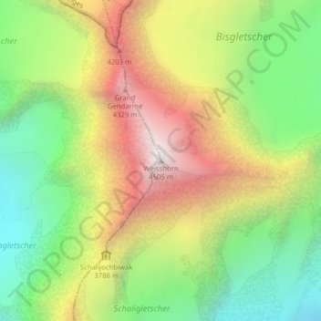
Name: Weisshorn topographic map, elevation, terrain.

Location: Weisshorn, Randa, Visp, Wallis, 3928, Switzerland (46.10118 7.71610 46.10128 7.71620)

Average elevation: 3,595 m

Minimum elevation: 2,894 m

Maximum elevation: 4,463 m

Gear up for your next adventure:

🥾Waterproof Hiking Shoes - Durable shoes for wet and rugged trails
🧭Orienteering Kit - Tools for map reading and navigation in the wild
💧Reusable Water Bottle - Durable water bottles for hydration on trails
Lightweight Camping Tent - Portable shelter optimized for Canadian backcountry camping
🛏️Camping Sleeping Mat - Comfortable mats for sleeping outdoors

As an Amazon Associate, this site earns from qualifying purchases at no extra cost to you.