Geolocate

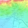
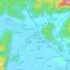
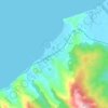
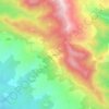
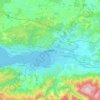
Erdek topographic map

Click on the map to display elevation.

Erdek

Erdek (formerly known as Artàke, Greek: Αρτάκη) is a municipality and district of Balıkesir Province, Turkey. Its area is 307 km2, and its population is 31,902 (2022). Located on the Kapıdağ Peninsula, on the north coast of the Gulf of Erdek at the south of the Sea of Marmara, Erdek is a popular domestic holiday destination with several hotels dating back to the 1960s. The surrounding area has a rugged geology and topography with evergreen wooded areas and large olive groves. It is dominated by Mt Dindymus (782m).

Wikipedia (CC-BY-SA 3.0)

About this map

Name: Erdek topographic map, elevation, terrain.

Location: Erdek, Balıkesir, Marmara Region, 10500, Turkey (40.36778 27.56088 40.52833 28.03463)

Average elevation: 68 m

Minimum elevation: -1 m

Maximum elevation: 791 m

Other topographic maps

Click on a map to view its topography, its elevation and its terrain.
Kalkan

Turkey > Kaş

Average elevation: 267 m

Göbekli Tepe

Turkey > Haliliye > Örencik Mahallesi

Average elevation: 703 m

Datça

Turkey > Datça > Datça

Average elevation: 78 m

Rize

Turkey > Rize Merkez > Rize

Average elevation: 263 m

Uludağ

Turkey > Osmangazi

Average elevation: 2,265 m

Onikişubat

Turkey > Onikişubat

Average elevation: 652 m

Hisarönü

Turkey > Marmaris

Average elevation: 161 m

Ankara Kalesi

Turkey > Altındağ

Average elevation: 890 m

Heybeliada

Turkey > Prince Islands

Average elevation: 11 m

Ortaca

Turkey > Ortaca > Ortaca

Average elevation: 89 m

Dikilitaş

Turkey > Gölbaşı > Dikilitaş > Dikilitaş

Average elevation: 1,070 m

Dalyan

Turkey > Ortaca > Dalyan

Average elevation: 48 m

Mahmutlar

Turkey > Alanya

Average elevation: 28 m

Filyos

Turkey > Çaycuma

Average elevation: 51 m

Yozgat

Turkey > Yozgat Merkez

Average elevation: 1,250 m

Sardis

Turkey > Salihli > Sart

Average elevation: 134 m

Viaport Theme Park

Turkey > Pendik

Average elevation: 126 m

Sait

Turkey > Tekman

Average elevation: 1,917 m

Havluburun

Turkey > Kartepe > Havluburun

Average elevation: 307 m

Ordu

Turkey > Altınordu

Average elevation: 239 m

Azizli

Turkey > Ceyhan

Average elevation: 126 m

Saltan

Turkey > Kulp > Baloğlu

Average elevation: 1,202 m

Silivri

Turkey > Silivri > Silivri

Average elevation: 28 m

Gaziantep

Turkey > Şahinbey

The plan introduced several important changes to the city's transportation network. One of the most important was the addition of a rail line to connect Gaziantep to the national rail system. Up to now, Turkish railway construction had ignored Gaziantep (partly because of its mountainous surroundings); a…

Average elevation: 880 m
Bostankaya

Turkey > Ulaş

Average elevation: 1,376 m

Belencik

Turkey > Başkale

Average elevation: 2,317 m

Ova

Turkey > Kocasinan

Average elevation: 1,117 m

Mihalıççık

Turkey > Mihalıççık > Mihalıççık

Mihalıççık, also Mihalıçcık (English: Micalizo, sometimes Mihaliccik), is a town and district of Eskişehir Province in the Central Anatolia region of Turkey. According to 2010 census, population of the district is 10,482 of which 3,133 live in the town of Mihalıççık. The district covers an area of…

Average elevation: 1,284 m
Dedem

Turkey > Tosya

Average elevation: 1,051 m

Geyre

Turkey > Karacasu

Average elevation: 522 m

Salur

Turkey > Çorum Merkez

Average elevation: 599 m

Karacaşehir

Turkey > Odunpazarı

Average elevation: 883 m

Çiftlik

Turkey

Average elevation: 139 m

Çağlayan

Turkey

Average elevation: 1,770 m

Bozkaya

Turkey > Musabeyli

Average elevation: 872 m

Bağlıca

Turkey > Adıyaman

Average elevation: 1,182 m

Zımak

Turkey > İmranlı

Average elevation: 2,064 m

Oğlakçı

Turkey > Yahyalı

Average elevation: 1,460 m

Merkez Dağı

Turkey > Başkale

Average elevation: 2,994 m

Gölbaşı

Turkey > Gölbaşı > Gölbaşı

Average elevation: 1,046 m

Kocaeli

Turkey > İzmit

Average elevation: 289 m

Seyhan

Turkey > Seyhan > Kuruköprü Mahallesi > Seyhan

Average elevation: 28 m

Oğlakçı

Turkey > Sivrihisar

Average elevation: 873 m

Şahintepe

Turkey > Kemah

Average elevation: 1,162 m

Emecik

Turkey > Datça > Emecik

Average elevation: 219 m

Yapracık

Turkey

Average elevation: 1,413 m

Gear up for your next adventure:

🧤Rechargeable Heated Gloves - Extreme warmth for Canadian winter expeditions
🧶550 Survival Paracord - Versatile utility cord for emergency repairs and rigging
🔦LED Headlamp - Hands-free lighting for early morning starts or late finishes
🧴Outdoor Sunscreen - High SPF protection for high-altitude UV exposure
🧰Emergency Multi-Tool - Compact multi-tool for outdoor survival

As an Amazon Associate, this site earns from qualifying purchases at no extra cost to you.