
Thank you for supporting this site ❤️
Make a donation
Make a donation
Gear up for your next adventure:
As an Amazon Associate, this site earns from qualifying purchases at no extra cost to you.
Onikişubat topographic map
Click on the map to display elevation.
Thank you for supporting this site ❤️
Make a donation
Make a donation
Gear up for your next adventure:
As an Amazon Associate, this site earns from qualifying purchases at no extra cost to you.
About this map
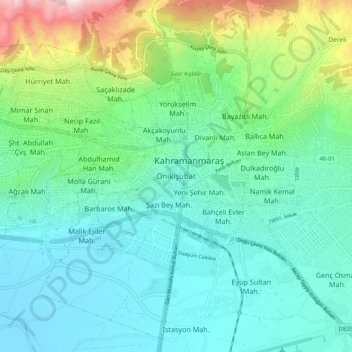
Name: Onikişubat topographic map, elevation, terrain.
Location: Onikişubat, Kahramanmaraş, Mediterranean Region, 36002, Turkey (37.53776 36.88374 37.61776 36.96374)
Average elevation: 652 m
Minimum elevation: 435 m
Maximum elevation: 1,393 m
Thank you for supporting this site ❤️
Make a donation
Make a donation
Gear up for your next adventure:
As an Amazon Associate, this site earns from qualifying purchases at no extra cost to you.