Geolocate

Filyos topographic map

Click on the map to display elevation.

About this map

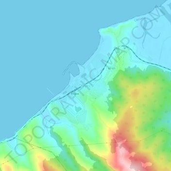
Name: Filyos topographic map, elevation, terrain.

Location: Filyos, Çaycuma, Zonguldak, Black Sea Region, 67970, Turkey (41.54095 32.00466 41.58095 32.04466)

Average elevation: 51 m

Minimum elevation: -4 m

Maximum elevation: 280 m

Gear up for your next adventure:

🥫Freeze-Dried Meals - Lightweight, high-calorie nutrition for multi-day treks
🔋Solar Power Bank - Keep your GPS and devices charged during long outdoor trips
🧴First Aid Kit - Essential first aid supplies for outdoor emergencies
🥾Trail Running Shoes - Lightweight and durable shoes for trail running
🧦Hiking Socks - Moisture-wicking and comfortable socks for long hikes

As an Amazon Associate, this site earns from qualifying purchases at no extra cost to you.