Geolocate

Ova topographic map

Click on the map to display elevation.

About this map

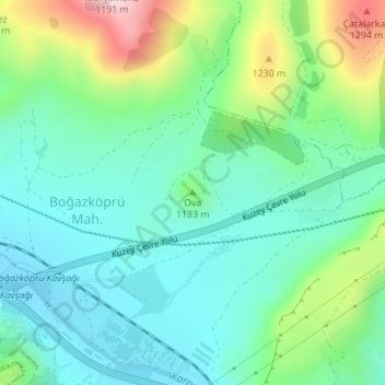
Name: Ova topographic map, elevation, terrain.

Location: Ova, Kocasinan, Kayseri, Central Anatolia Region, Turkey (38.77721 35.30668 38.77731 35.30678)

Average elevation: 1,117 m

Minimum elevation: 1,025 m

Maximum elevation: 1,357 m

Gear up for your next adventure:

🧥Thermal Fleece Jacket - Versatile insulation for changing mountain temperatures
🥾Trail Running Shoes - Lightweight and durable shoes for trail running
🐕Hiking Dog Pack - Let your canine companion carry their own water and food
🧴Outdoor Sunscreen - High SPF protection for high-altitude UV exposure
Bushcraft Tarp - Versatile emergency shelter or gear protection

As an Amazon Associate, this site earns from qualifying purchases at no extra cost to you.