Geolocate

Bostankaya topographic map

Click on the map to display elevation.

About this map

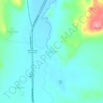
Name: Bostankaya topographic map, elevation, terrain.

Location: Bostankaya, Ulaş, Sivas, Central Anatolia Region, Turkey (39.49075 36.99869 39.53075 37.03869)

Average elevation: 1,376 m

Minimum elevation: 1,349 m

Maximum elevation: 1,494 m

Gear up for your next adventure:

🧥Waterproof Pants - Keep dry during rainy hiking conditions
🥾Approach Boots - Comfortable boots for hiking and climbing approaches
🧢Beanie Hat - Keep your head warm in cold weather
🩹Moleskin Blister Pads - Direct protection for painful foot pressure points
🧦Hiking Liner Socks - Thin base layer to prevent friction and blisters

As an Amazon Associate, this site earns from qualifying purchases at no extra cost to you.