Geolocate

Datça topographic map

Click on the map to display elevation.

About this map

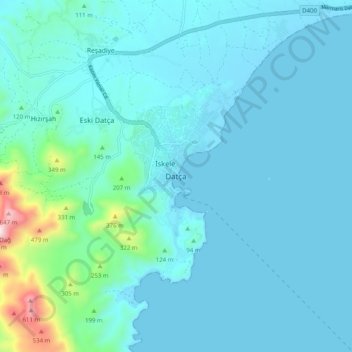
Name: Datça topographic map, elevation, terrain.

Location: Datça, Muğla, Aegean Region, Turkey (36.68634 27.64739 36.76634 27.72739)

Average elevation: 78 m

Minimum elevation: -2 m

Maximum elevation: 713 m

Gear up for your next adventure:

🧥Insulated Jacket - Keep warm in cold outdoor conditions
Camping Coffee Maker - Brew fresh coffee anywhere on the topographic map
💡Portable Camping Lamp - Rechargeable lamp for campsite lighting
🧭GPS Handheld Device - Reliable GPS navigation for outdoor adventures
🧦Hiking Liner Socks - Thin base layer to prevent friction and blisters

As an Amazon Associate, this site earns from qualifying purchases at no extra cost to you.