Geolocate

Emecik topographic map

Click on the map to display elevation.

About this map

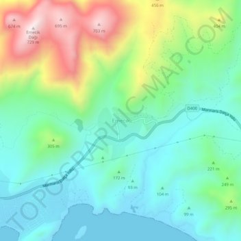
Name: Emecik topographic map, elevation, terrain.

Location: Emecik, Datça, Muğla, Aegean Region, Turkey (36.75814 27.79445 36.79814 27.83445)

Average elevation: 219 m

Minimum elevation: -1 m

Maximum elevation: 741 m

Gear up for your next adventure:

🗺️Topographic Maps - Detailed maps to explore trails, mountains, and wilderness areas
🦯Trekking Poles - Reduced impact on joints for steep topographic climbs
🔭Compact Binoculars - Lightweight optics for scouting trails and wildlife
🥾Waterproof Trail Shoes - Shoes designed to handle wet terrain
🥾Waterproof Hiking Boots - Essential footwear for rugged terrain and wet Canadian trails

As an Amazon Associate, this site earns from qualifying purchases at no extra cost to you.