Geolocate

Geyre topographic map

Click on the map to display elevation.

About this map

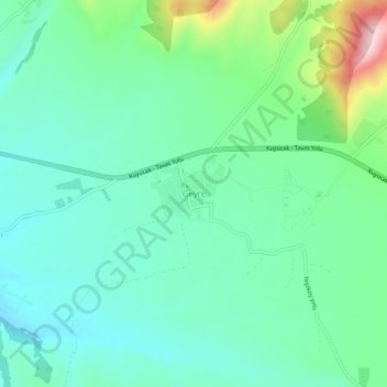
Name: Geyre topographic map, elevation, terrain.

Location: Geyre, Karacasu, Aydın, Aegean Region, Turkey (37.68965 28.69084 37.72965 28.73084)

Average elevation: 522 m

Minimum elevation: 443 m

Maximum elevation: 765 m

Gear up for your next adventure:

💧Hydration Bladder - Hands-free hydration solution for long treks
💡Portable Camping Lamp - Rechargeable lamp for campsite lighting
Camping Essentials - All-in-one gear for a comfortable camping trip
🧭GPS Handheld Device - Reliable GPS navigation for outdoor adventures
🪑Insulated Seat Pad - Protect your seat from cold rocks and wet logs

As an Amazon Associate, this site earns from qualifying purchases at no extra cost to you.