
Salur topographic map
Click on the map to display elevation.
About this map
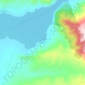
Name: Salur topographic map, elevation, terrain.
Location: Salur, Çorum Merkez, Çorum, Black Sea Region, Turkey (40.60909 34.61291 40.64909 34.65291)
Average elevation: 599 m
Minimum elevation: 501 m
Maximum elevation: 918 m