
Ravens Knowe topographic map
Interactive map
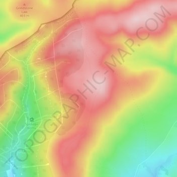
Click on the map to display elevation.
About this map
Name: Ravens Knowe topographic map, elevation, terrain.
Average elevation: 427 m
Minimum elevation: 288 m
Maximum elevation: 524 m
Other topographic maps
Click on a map to view its topography, its elevation and its terrain.
Little Stanney Wood
United Kingdom > England > Cheshire West and Chester > Stoak > Little Stanney
Average elevation: 11 m
Suffolk
The west of the county lies on more resistant Cretaceous chalk. This chalk is responsible for a sweeping tract of largely downland landscapes that stretches from Dorset in the south west to Dover in the south east and north through East Anglia to the Yorkshire Wolds. The chalk is less easily eroded so forms…
Average elevation: 35 m
Lake District National Park
The Lake District is a roughly circular upland massif, deeply dissected by a broadly radial pattern of major valleys which are largely the result of repeated glaciations over the last 2 million years. The apparent radial pattern is not from a central dome, but from an axial watershed extending from St Bees…
Average elevation: 206 m
Exeter
United Kingdom > England > Devon
The city of Exeter was established on the eastern bank of the River Exe on a ridge of land backed by a steep hill. It is at this point that the Exe, having just been joined by the River Creedy, opens onto a wide flood plain and estuary which results in quite common flooding. Historically this was the lowest…
Average elevation: 56 m
Northampton
United Kingdom > England > West Northamptonshire > Northampton
As with the rest of the British Isles, Northampton experiences an oceanic climate with cool summers and mild winters. The official Met Office weather station for Northampton is the Moulton Park Weather Station at the University of Northampton. Situated at an elevation of around 130 m (427 ft) above sea level…
Average elevation: 89 m
Hathersage
United Kingdom > England > Derbyshire > Derbyshire Dales
The Fat Boys Stanage Struggle is a popular local fell race that starts in Hathersage, altitude 91 metres (299 ft), and routes up to and along Stanage Edge to High Neb, 458 metres (1,503 ft), before returning to the village 367 metres (1,204 ft) below.
Average elevation: 311 m
Bakewell CP
United Kingdom > England > Derbyshire > Derbyshire Dales
The Manchester, Buxton, Matlock and Midlands Junction Railway opened Bakewell railway station in 1862, then became part of the Midland Railway and later of the LMS main line from London to Manchester. John Ruskin objected to what he saw as desecration of the Derbyshire countryside and to the fact that "every…
Average elevation: 194 m
Sconce and Devon Park
United Kingdom > England > Nottinghamshire > Newark and Sherwood > Newark on Trent
Average elevation: 15 m
Ipswich
United Kingdom > England > Suffolk
Ipswich experiences an oceanic climate, like the rest of the British Isles, with a narrow range of temperature and rainfall spread evenly throughout the year. One of the two nearest for which data is available is East Bergholt, about 7 miles (11 km) south west of the town centre and at a similar elevation, and…
Average elevation: 29 m
Birmingham
Like most other large cities, Birmingham has a considerable urban heat island effect. During the coldest night recorded, 14 January 1982, the temperature fell to −20.8 °C (−5.4 °F) at Birmingham Airport, but just −14.3 °C (6.3 °F) at Edgbaston, near the city centre. Birmingham is a snowy city…
Average elevation: 138 m
Hertfordshire
Elevations are higher in the north and west, reaching more than 800 feet (240 m) in the Chilterns near Tring. The county centres on the headwaters and upper valleys of the rivers Lea and the Colne; both flow south and each is accompanied by a canal. Hertfordshire's undeveloped land is mainly agricultural and…
Average elevation: 82 m
Earl Shilton
United Kingdom > England > Leicestershire > Hinckley and Bosworth
Average elevation: 101 m
Kitcher's Pond
United Kingdom > England > Hertfordshire > East Hertfordshire > Albury
Average elevation: 106 m
Clungunford
United Kingdom > England > Shropshire
Clungunford lies at an elevation of between 130m and 145m above sea level.
Average elevation: 181 m
Crowborough
United Kingdom > England > East Sussex > Wealden
In the late 19th century, Crowborough was promoted as a health resort based on its high elevation, the rolling hills and surrounding forest. Estate Agents even called it "Scotland in Sussex". The town's golf course opened in 1895, followed by a fire station and hospital in 1900.
Average elevation: 146 m
Warlingham
United Kingdom > England > Surrey > Tandridge
Elevations vary from 110m AOD at Woldingham Road, at the southernmost point of the parish, with a gentle increase in height through the village along the main road heading to the southeast, to the highest elevation (199.6m) at Limpsfield Road.
Average elevation: 163 m