Geolocate

Hartland topographic map

Click on the map to display elevation.

About this map

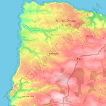
Name: Hartland topographic map, elevation, terrain.

Location: Hartland, Torridge District, Devon, England, United Kingdom (50.92886 -4.55174 51.02302 -4.41269)

Average elevation: 118 m

Minimum elevation: 0 m

Maximum elevation: 233 m

Gear up for your next adventure:

🔋Solar Power Bank - Keep your GPS and devices charged during long outdoor trips
🎒Hiking Backpack - Lightweight and ergonomic backpacks for day hikes or multi-day treks
Lightweight Backpacking Tent - Compact tent for efficient hiking trips
🥾Mountaineering Boots - Supportive boots for climbing and high-altitude hiking
🌬️Windproof Camp Stove - Efficient cooking even on exposed mountain peaks

As an Amazon Associate, this site earns from qualifying purchases at no extra cost to you.