
Crowborough topographic map
Click on the map to display elevation.
Crowborough
In the late 19th century, Crowborough was promoted as a health resort based on its high elevation, the rolling hills and surrounding forest. Estate Agents even called it "Scotland in Sussex". The town's golf course opened in 1895, followed by a fire station and hospital in 1900.
About this map
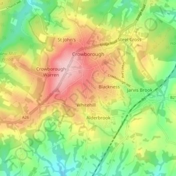
Name: Crowborough topographic map, elevation, terrain.
Location: Crowborough, Wealden, East Sussex, England, United Kingdom (51.02955 0.11916 51.06922 0.19790)
Average elevation: 146 m
Minimum elevation: 64 m
Maximum elevation: 244 m
Other topographic maps
Click on a map to view its topography, its elevation and its terrain.