
Grenfell topographic map
Click on the map to display elevation.
About this map
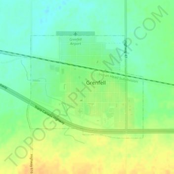
Name: Grenfell topographic map, elevation, terrain.
Location: Grenfell, Saskatchewan, S0G 2B0, Canada (50.40269 -102.94684 50.41865 -102.91854)
Average elevation: 601 m
Minimum elevation: 587 m
Maximum elevation: 615 m
Saskatchewan trails, hiking, mountain biking, running and outdoor activities
Other topographic maps
Click on a map to view its topography, its elevation and its terrain.
McClean Lake
Canada > Saskatchewan > Division No. 18 > Unorganized Division No. 18
Average elevation: 440 m
La Loche
Canada > Saskatchewan > Northern Saskatchewan Administration District > La Loche
Average elevation: 447 m
Pelican Narrows
Canada > Saskatchewan > Northern Saskatchewan Administration District > Pelican Narrows
Average elevation: 321 m