Geolocate

Saskatoon topographic map

Click on the map to display elevation.

About this map

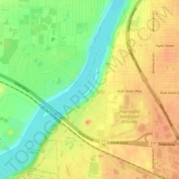
Name: Saskatoon topographic map, elevation, terrain.

Location: Saskatoon, Census Division No. 11, Saskatchewan, Canada (52.09982 -106.68760 52.10169 -106.68495)

Average elevation: 492 m

Minimum elevation: 470 m

Maximum elevation: 508 m

Saskatchewan trails, hiking, mountain biking, running and outdoor activities

Other topographic maps

Click on a map to view its topography, its elevation and its terrain.

Mayfair

Canada > Saskatchewan > Saskatoon

Average elevation: 500 m

Haultain

Canada > Saskatchewan > Saskatoon

Average elevation: 504 m

Queen Elizabeth

Canada > Saskatchewan > Saskatoon

Average elevation: 504 m

Evergreen

Canada > Saskatchewan > Saskatoon

Average elevation: 505 m

Rosewood

Canada > Saskatchewan > Saskatoon

Average elevation: 513 m

Parkridge

Canada > Saskatchewan > Saskatoon

Average elevation: 505 m

Gear up for your next adventure:

🧴Insect Repellent - Protect yourself from bugs during outdoor adventures
🥘Camping Cookware Set - Compact nesting pots and pans for trail cooking
Tent Footprint - Protect tent floor and increase durability
🥾Waterproof Hiking Shoes - Durable shoes for wet and rugged trails
🌬️Windproof Camp Stove - Efficient cooking even on exposed mountain peaks

As an Amazon Associate, this site earns from qualifying purchases at no extra cost to you.