Geolocate

Alida topographic map

Click on the map to display elevation.

About this map

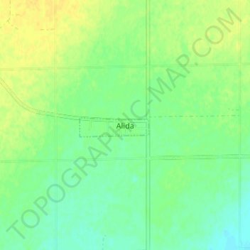
Name: Alida topographic map, elevation, terrain.

Location: Alida, Reciprocity No. 32, Saskatchewan, Canada (49.36897 -101.89274 49.40897 -101.85274)

Average elevation: 570 m

Minimum elevation: 560 m

Maximum elevation: 581 m

Reciprocity No. 32 trails, hiking, mountain biking, running and outdoor activities

Gear up for your next adventure:

🥾Hiking Leggings - Comfortable leggings for outdoor activities
🦌Outdoor Trail Camera - Monitor wildlife activity near your favorite spots
🦶Anti-Blister Balm - Prevents friction and hotspots during long ascents
🎒Hiking Backpack - Lightweight and ergonomic backpacks for day hikes or multi-day treks
🧴Bear Spray Holster - Quick-access carry for essential Canadian wilderness safety

As an Amazon Associate, this site earns from qualifying purchases at no extra cost to you.