
Thank you for supporting this site ❤️
Make a donation
Make a donation
Gear up for your next adventure:
As an Amazon Associate, this site earns from qualifying purchases at no extra cost to you.
Sonningdale topographic map
Click on the map to display elevation.
Thank you for supporting this site ❤️
Make a donation
Make a donation
Gear up for your next adventure:
As an Amazon Associate, this site earns from qualifying purchases at no extra cost to you.
About this map
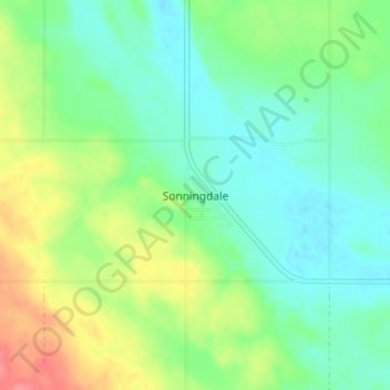
Name: Sonningdale topographic map, elevation, terrain.
Location: Sonningdale, Eagle Creek No. 376, Saskatchewan, Canada (52.36549 -107.70189 52.40549 -107.66189)
Average elevation: 580 m
Minimum elevation: 557 m
Maximum elevation: 627 m
Eagle Creek No. 376 trails, hiking, mountain biking, running and outdoor activities
Thank you for supporting this site ❤️
Make a donation
Make a donation
Gear up for your next adventure:
As an Amazon Associate, this site earns from qualifying purchases at no extra cost to you.