Geolocate

Weyburn topographic map

Click on the map to display elevation.

About this map

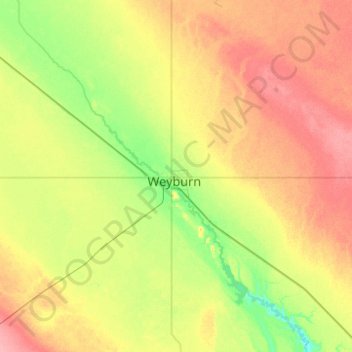
Name: Weyburn topographic map, elevation, terrain.

Location: Weyburn, Saskatchewan, S4H 2J4, Canada (49.50941 -104.01101 49.82941 -103.69101)

Average elevation: 585 m

Minimum elevation: 553 m

Maximum elevation: 625 m

Weyburn trails, hiking, mountain biking, running and outdoor activities

Gear up for your next adventure:

💧Hydration Pack - Hands-free hydration system for long hikes
🧴Bear Spray Holster - Quick-access carry for essential Canadian wilderness safety
🥾Approach Shoes - Shoes designed for climbing approaches and rugged trails
🗺️Topographic Maps - Detailed maps to explore trails, mountains, and wilderness areas
Bushcraft Tarp - Versatile emergency shelter or gear protection

As an Amazon Associate, this site earns from qualifying purchases at no extra cost to you.