
Malua topographic map
Click on the map to display elevation.
About this map
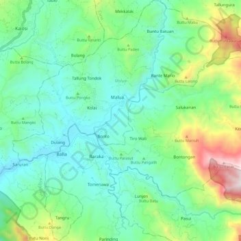
Name: Malua topographic map, elevation, terrain.
Location: Malua, Enrekang, South Sulawesi, Sulawesi, 91753, Indonesia (-3.44804 119.81591 -3.33858 119.92226)
Average elevation: 709 m
Minimum elevation: 396 m
Maximum elevation: 1,606 m
Other topographic maps
Click on a map to view its topography, its elevation and its terrain.