Geolocate

Tallang Rilau topographic map

Click on the map to display elevation.

About this map

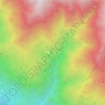
Name: Tallang Rilau topographic map, elevation, terrain.

Location: Tallang Rilau, Enrekang, South Sulawesi, Sulawesi, Indonesia (-3.60551 119.98834 -3.56551 120.02834)

Average elevation: 1,274 m

Minimum elevation: 471 m

Maximum elevation: 1,983 m

Other topographic maps

Click on a map to view its topography, its elevation and its terrain.

Baraka

Indonesia > South Sulawesi > Enrekang

Average elevation: 827 m

Bungin

Indonesia > South Sulawesi > Enrekang

Average elevation: 1,238 m

Buntu Batu

Indonesia > South Sulawesi > Enrekang

Average elevation: 1,459 m

Cendana

Indonesia > South Sulawesi > Enrekang

Average elevation: 152 m

Maiwa

Indonesia > South Sulawesi > Enrekang

Average elevation: 214 m

Malua

Indonesia > South Sulawesi > Enrekang

Average elevation: 709 m

Malua

Indonesia > South Sulawesi > Enrekang

Average elevation: 709 m

Alla

Indonesia > South Sulawesi > Enrekang

Average elevation: 1,037 m

Gear up for your next adventure:

🥾Hiking Shorts - Breathable shorts suitable for summer hikes
🥾Light Trekking Boots - Supportive boots for multi-day treks
🥾Waterproof Trail Shoes - Shoes designed to handle wet terrain
🥽Outdoor Goggles - Protective eyewear for outdoor activities
🧦Hiking Socks - Moisture-wicking and comfortable socks for long hikes

As an Amazon Associate, this site earns from qualifying purchases at no extra cost to you.